JBS fails to act on deforestation alerts leading to more than 18,000 hectares of Amazon and Cerrado destruction
Read in Portuguese and Spanish
Link to report and deforestation cases
Link to media coverage in Folha de S.Paulo
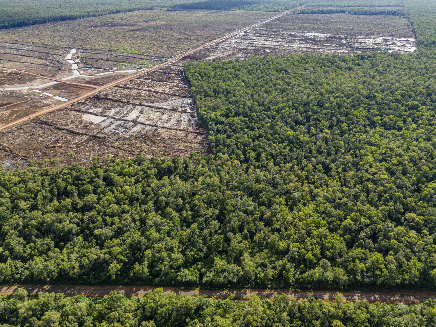
New analysis by Mighty Earth and AidEnvironment shows the failure of Brazilian meat giant JBS to act on 68 cases of deforestation on cattle farms in the Amazon and Cerrado, sent to the company over a year ago, has resulted in a further 18,458 hectares of preventable destruction of crucial rainforest and natural ecosystems, some close to the ancestral lands of Indigenous peoples. The new research, released ahead of JBS’ AGM in Brazil today finds that, in total, JBS has failed to investigate or verifiably act on 105 deforestation alerts – covering over 185,000 hectares of deforestation – in the two threatened biomes.
It comes as opposition grows to JBS’ plan to list on the New York Stock Exchange, given the meat giant’s outsized impact on climate and nature. This week, ahead of the company’s shareholder meeting in São Paulo, a considerable number of JBS investors, voting remotely, rejected resolutions to allow the scandal-plagued Batista brothers – Joesely and Wesley – back on the JBS S.A board.
Timeline
- In April last year, we revealed 68 cases of deforestation on 59 farms, covering more than 125,000 hectares linked to JBS’ cattle supply chain in Brazil – but JBS refused to act or investigate. The analysis used DETER (Deforestation Detection in Real Time) data, further confirmed with high-resolution satellite imagery.
- One year on the data has been reassessed using PRODES (Project for Monitoring Deforestation in the Legal Amazon by Satellite) annual deforestation satellite data. Of the 68 cases we identified, PRODES data confirmed 60 of the cases with total deforestation of 51,579 hectares, between August 2018 and July 2023.
- The new research found 18,458 hectares of further, preventable deforestation on 22 of the 59 farms has also been identified, since the initial clearance was detected. Of the 22 farms, four border or overlap with protected Indigenous Lands.
- In March of this year, Mighty Earth sent JBS 37 additional cases of deforestation and conversion in the Amazon and Cerrado, covering 60,218 hectares on farms linked to JBS.
- Combining last year’s analysis with new research this year, we have identified a total of 105 deforestation cases linked to JBS’ beef supply chain in Brazil, covering over 185,000 hectares of deforestation.
JBS’ failure to act
JBS told Mighty Earth last year that it would not investigate the 68 deforestation cases identified by DETER, insisting it relies solely on PRODES data, which reports deforestation rates annually. Brazil’s National Institute for Space Research, INPE, says both systems are complementary, representing powerful tools for the Brazilian government and the private sector to monitor, identify and act on deforestation quickly.
Recently, JBS told Mighty Earth that 88% of the 105 deforestation cases are not currently JBS suppliers and that 60% of cases were not found in JBS’ cattle supplier database. It claims the remaining 12% comply with its cattle procurement policies and are eligible to sell cattle to the company. However, JBS has provided no evidence to support or verify these claims.
João Gonçalves, Senior Director (Brazil) at Mighty Earth, said:
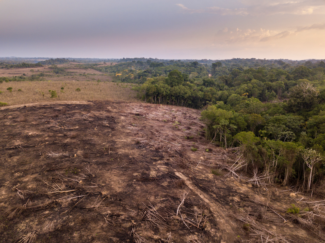
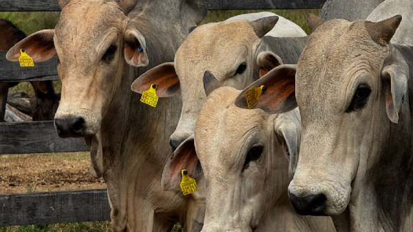
“By failing to act, JBS has allowed the preventable destruction of over 18,000 hectares of Amazon rainforest and Cerrado savannah on farms linked to its massive beef operations. Our research shows JBS’ suppliers continue to destroy nature for cattle ranching with impunity, threatening Indigenous communities, escalating land grabs, and fuelling climate pollution. We urge JBS investors, gathering at the company’s shareholder meeting in Brazil today, to vote against bringing back the scandal-plagued Batista brothers to the board, and to block JBS’ proposed listing on the New York Stock Exchange over its outsized impact on the Amazon and climate change.”
Mighty Earth is calling on JBS to:
- Use early warning systems such as DETER satellite data to detect deforestation at its earliest stages and to respond with urgency and full transparency.
- Act immediately on deforestation alerts that have been confirmed using satellite imagery by suspending suppliers complicit in clearances to stop any deforestation and conversion at the 10-hectare level, before it gets to the 1,000-ha or 10,000-ha level.
- Establish a public grievance mechanism which documents what JBS is doing to investigate cases, the status of any alleged deforestation or human rights complaint, and all actions taken for each case.
- Update JBS´ policy to end deforestation and conversion from all areas and biomes through its direct and indirect supply chain by January 2025, so it fully protects all natural ecosystems, people and wildlife.
The new analysis is revealed as thousands of Indigenous people gather in Brasilia in Brazil for the 20th Acampamento Terra Livre or ‘Free Land Camp’. They are calling for “measures to eliminate the impacts of the commodity production and export chains in Indigenous Territories, including the adoption of a national system of traceability and the endorsement of international regulations that seek to promote deforestation-free and rights-violation production chains.”
UPDATE: In a statement to Folha de S.Paulo, Brazil’s biggest newspaper, in April and responding to our report, JBS said that “it is now using DETER date as a criterion for blocking suppliers.”
Ends
Notes to Editors:
A previous version of this report stated 16,843 hectares of additional deforestation across 21 farms. Updated numbers reflect the inclusion of recent PRODES data for the Pantanal biome.
What is DETER?
The Real-Time System for Detection of Deforestation, or DETER provides daily deforestation alerts at medium spatial resolution, so that Brazilian environmental law enforcement agencies can quickly identify and inspect new forest clearing areas in the Amazon and Cerrado. As an early warning system, DETER allows a rapid response deforestation monitoring system to locate illegal deforestation starting at 3 hectares. Analysts argue that DETER alerts serve as a strong launching pad for investigating deforestation in real-time, especially when visually confirmed with high-resolution satellite imagery.
What is PRODES?
The Project for Monitoring Deforestation in the Legal Amazon by Satellite or PRODES, generates an annual deforestation rate for the Amazon and uses high-resolution satellite data to identify areas that have been cleared between September of the previous year and August of any current year. Losses are identified starting at 6.25 hectares – however, deforestation of smaller areas does not enter the annual rate. Analysts say PRODES offers robust estimates of annual deforestation rates, but it is not aimed at carrying out real-time monitoring of ongoing deforestation.
For more information on DETER and PRODES, see: