Monitoring Report: Mayawana Persada
Monitoring Report
October 2024 Update: Reviewing the available daily Planet satellite imagery for June, July, August and September, we have identified additional limited deforestation in Area 1 [~6 ha], but no obvious deforestation in any of the other areas. An additional 50ha of land clearing activity had been picked in another area, but available data suggests this was an area already cleared between August 2021 and November 2021. While it took some time for the stop work order to be implemented, it is generally being upheld.
June 2024 Report Below
Bahasa Indonesia Translation: Terjemahan dalam bahasa Indonesia
Background
The PT Mayawana Persada concession is located in West Kalimantan on the Island of Borneo. It spans nearly 140,000 ha, including 90,000 ha of orangutan habitat and more than 83,000 ha of carbon rich peatland. Indigenous land and customary forests are also within the concession boundaries.
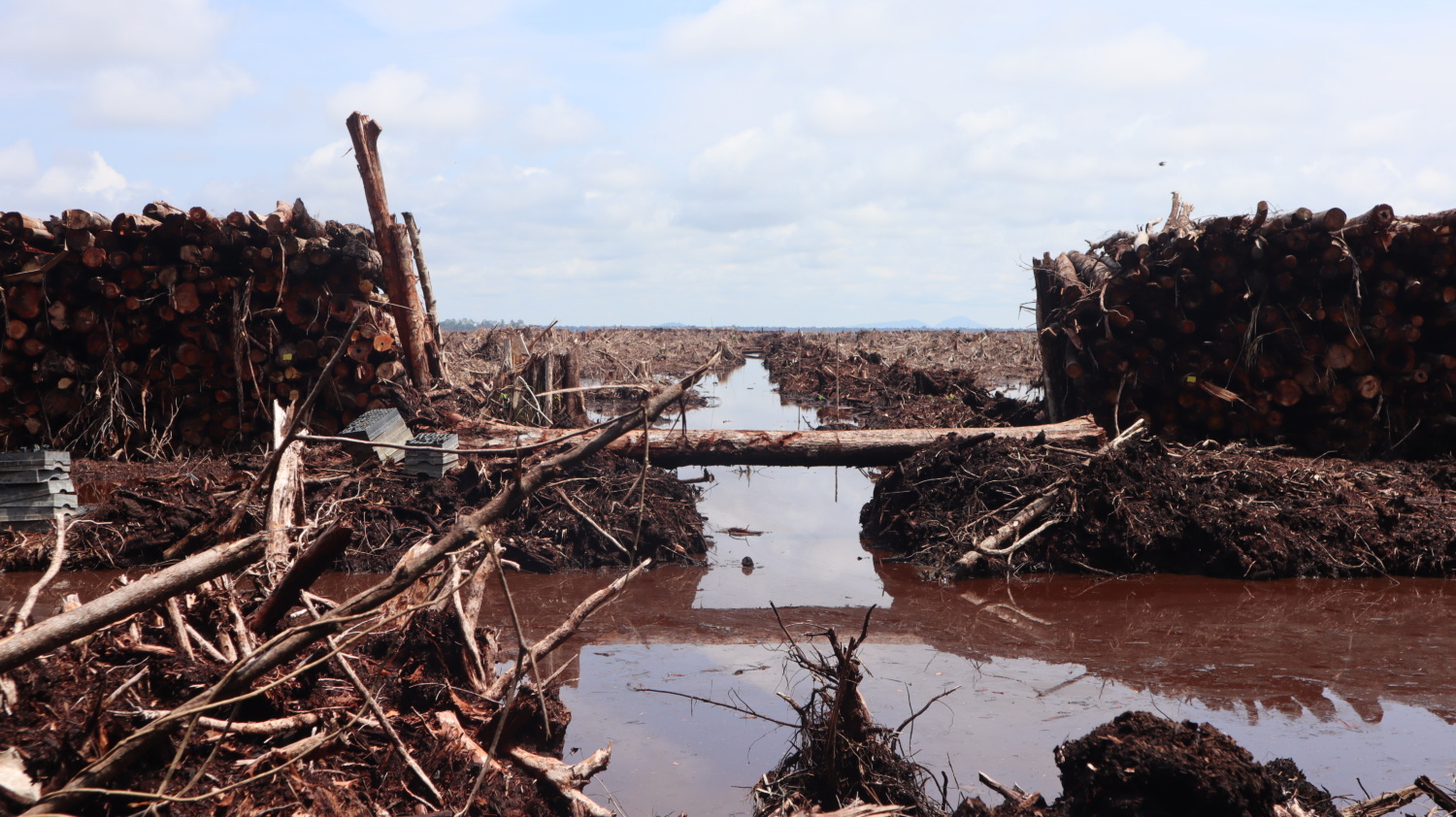
Almost 40,000 hectares have been cleared since 2016 in the PT Mayawana Persada concession. Nearly 20,000 ha of clearance occurred in 2023 alone. The massive scale of destruction stands out in the context of the overall decline in commodity-driven deforestation throughout SE Asia.
Mighty Earth filed a Forest Stewardship Council (FSC) complaint against the Alas Kusuma group (owner of PT Mayawana Persada until at least December 2023) which was accepted late last year.
On March 28th, 2024, the Indonesian Ministry of Forestry and Environment (KLHK) issued a letter directing PT Mayawana Persada to stop all forest clearing activities and instead focus on planting industrial forest in open land and shrubland, in addition to environmental restoration.
The following forest monitoring report seeks to quantify how much forest area has been cleared in the PT Mayawana Persada plantation since the letter was issued. We estimate total forest clearance, logging and infrastructure development to be about 96 ha since the letter from KLHK. This estimate may be underestimated based on the availability of cloud free imagery from 28 March to the beginning of April.
Methodology
To quantify the deforestation that occurred since March 28th, we used recent daily medium (3 meters) and high resolution (50 centimeters) satellite imagery from Planet Labs of the 4 areas shown below and compared them to daily cloud-free imagery from the beginning of April. We used additional sources to determine whether an area was likely forest.

Map of 4 areas where clearance has occurred within Mayawana Persada concession since March 28th
Area 1
For Area 1, located in the northwest of the concession, we compared imagery from April 2nd to imagery from May 27th . Overlayed with High Carbon Stock (HCS) map, our imagery shows that ~12 ha of forest were cleared between 2 April 2024 and 27 May 2024. The other area cleared appears to be scrub. It appears that clearance may be ongoing.


Comparison of Area 1 between 2 April 2024 (above) and 27 May 2024 (below). Imagery from Planet.
Area 2
For Area 2, located in the northeast of the concession, we compared imagery from 2 April 2024 to imagery from 19 May 2024. While the 2023 KLHK land cover map from 2023 classifies this as secondary swamp forest, other HCV assessments identify these areas as non-forest agricultural land (e.g. rice paddies). Our analysis shows that ~70 ha of non-forest land has been cleared. It appears that the clearing stopped by 30 April 2024.


Comparison of Area 2 between 2 April 2024 (above) and 19 May 2024 (below). Imagery from Planet.
Area 3
For Area 3, located in the southeast of the concession, we compared imagery from 2 April 2024 to imagery from 19 May 2024. Our analysis shows that ~17 ha of forested land has been logged and ~4 ha of already-logged forest was cleared completely. The clearing appears to have stopped by 19 May 2024. Area 3 falls within orangutan habitat according to the PHVA from 2016.


Comparison of Area 3 between 2 April 2024 (above) and 19 May 2024 (below). Imagery from Planet.
Area 4
For Area 4, located in the southwest of the concession, we compared imagery from 3 April 2024 to imagery from 27 May 2024. Our analysis shows that ~13 ha of forest has been logged in preparation and ~49 ha of forest was cleared completely. The clearing appears to have stopped by 25 April 2024. Area 4 contains orangutan habitat (including significant densities as identified by a field investigation in March 2024) and peatland, according to the 2017 KLHK peat map.


Comparison of Area 4 between 3 April 2024 (above) and 27 May 2024 (below). High resolution imagery from Planet.
Summary
The table below lists the deforestation amount and type for each of the four areas, in addition to whether or not the areas contain peat and orangutan habitat.
Demands
Along with a coalition of Civil Society Organizations working alongside community members near the Mayawana Persada concession, we ask that Alas Kusuma and Mayawana Persada take the following actions:
- Provide restitution for sacred land to communities
- Remedy conflict with communities
- Restore areas of impacted forest, peatland and orangutan habitat. Immediately dam the peatland canals in the southern part of the concession
- Disclose the ultimate beneficial owners of Green Ascend and Beihai International (two companies registered in secrecy jurisdictions that currently hold majority shares in Mayawana Persada)
- Ensure clearance of forest land, peatland and orangutan habitat does not resume
If the company does not take the above actions in a timely fashion, the government should revoke its permits to operate.


